Santa Ana volcano, also known as Ilamatepec — “old woman’s hill” in Nahuatl — is the highest volcano in El Salvador at 2,381 metres. Its crater holds a turquoise lake, and the walk to the rim is one of the most spectacular short hikes in Central America.
The volcano in brief
Ilamatepec is an active stratovolcano inside Los Volcanes National Park, in Santa Ana department. It forms a complex with Cerro Verde and Izalco volcano.
- Height: 2,381 metres above sea level.
- Last eruption: 1 October 2005.
- Where: western El Salvador, about 67 km from San Salvador — an hour and a half by car.
The crater and the turquoise lake
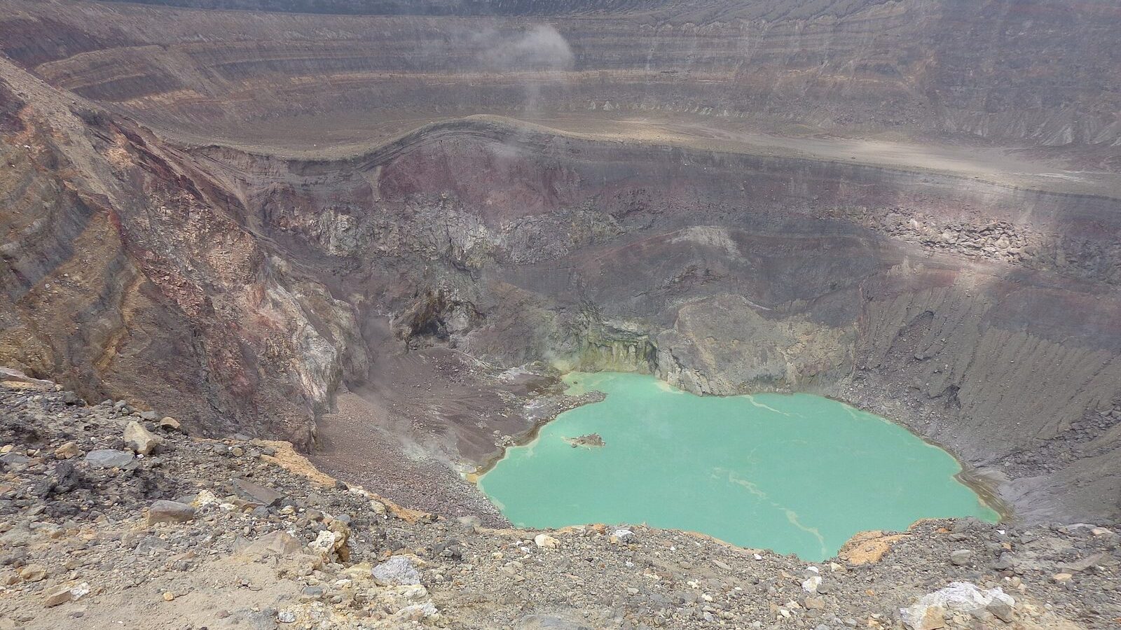
The main attraction is the crater, about 1.5 km across, holding a startlingly turquoise lake. The colour comes from minerals and sulphurous gases dissolved in the water. Active fumaroles on the crater walls are a reminder that the volcano is still alive.
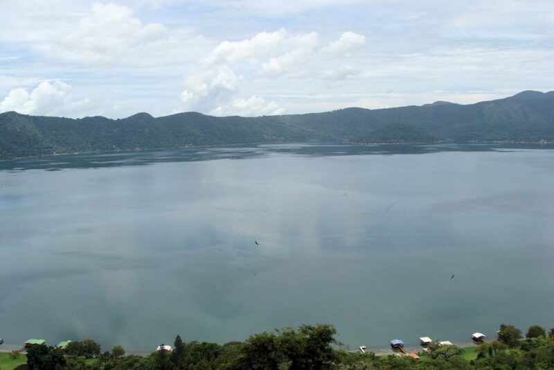
From the rim you also look out over Lake Coatepeque, Izalco volcano — the old “lighthouse of the Pacific” — and, on a clear day, as far as the Pacific coast and Guatemala.
The hike
The numbers
- Distance: around 5 to 6 km return.
- Time: 3 to 4 hours in total — an hour and a half to two up, an hour to an hour and a half down.
- Ascent: approximately 700 metres.
- Difficulty: moderate to hard.
- Start: Cerro Verde visitor centre, at 1,829 metres.
The trail
The official trail starts in Cerro Verde National Park and passes through several ecosystems: shaded cloud forest of sweetgum and oak for the first half hour; a transition zone of lower scrub and wildflowers; then bare volcanic ground of rock and ash; and finally a steep last stretch of fifteen or twenty minutes onto the rim.
It is well marked but includes steep, rocky sections. Near the crater the ground is loose volcanic ash and can be slippery.
Rules and requirements
Since the 2005 eruption the climb has been regulated by the Salvadoran tourism institute and requires:
- An authorised guide. You cannot go up alone.
- Fixed departure times. Groups leave at 7:00 and at 11:00.
- Park entrance and guide fees, paid separately and in cash.
- Private tours from operators are available and usually include transport.
Groups are escorted by guides and, at times, by tourist police.
What to bring
- Hiking boots or trainers with real grip — the ash is loose.
- A windproof layer: the rim is exposed and much colder than the car park.
- At least a litre and a half of water per person.
- Sun hat and sunscreen; there is no shade above the forest.
- Cash for the fees.
When to go
The dry season, November to April, gives the best chance of a clear crater. Take the 7:00 group: by late morning cloud usually rolls in and the lake disappears.
It combines naturally with Lake Coatepeque, twenty minutes away, and can be done as a day trip from San Salvador or from the coast.
Fees, departure times and access rules change. Confirm with the park before travelling.